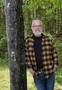
• Skip to primary navigation
  • Skip to main content
Haliburton Highlands Land Trust

Haliburton Highlands Land Trust

Protecting the land we love for future generations

donate
  • About
    • Introduction
    • Board and Staff
    • AGM & Audited Financials
    • Strategic Plan
    • Videos
    • Privacy Policy
    • Code of Ethics and Governing Principles
  • Properties
    • Haliburton Land Trust Property Map
    • Barnum Creek Nature Reserve
    • Dahl Forest
    • Fred & Pearl Barry Wetland Reserve
    • Norah’s Island
    • Smith Forest
    • Hadlington Reserve
    • Hiking Trails
    • Trail Etiquette and Safety
  • Projects
    • Current Projects
    • Partners In Conservation Program
    • The Highlands Corridor
    • Conservation
    • Education
    • Research
  • Species at Risk
    • Introduction
    • Amphibians
    • Birds
    • Insects
    • Plant Life
    • Mammals
    • Reptiles
  • How You Can Help
    • Donate
    • Adopt an Acre
    • Business Sponsorships
    • Donate/Conserve Land
      • Land Donation
      • Land Conservation & Stewardship
    • Become A Partner In Conservation
      • Partners In Conservation Resources
    • Legacy Giving
    • Volunteer
    • Gifts and Shopping
    • Become a Friend of HHLT
  • News & Events
    • Intro to News and Events
    • News
    • Events and Registration
  • Contact
  • Search
home > Archives for Adrian Martin

Adrian Martin

New Job Opening: Executive Director

April 10, 2026

Executive Director

About The Haliburton Highlands Land Trust (HHLT)

HHLT is a not-for-profit charitable organization focused on the conservation of the natural
heritage of Haliburton County, Ontario. It currently owns and protects 7 nature reserves comprising more than 1500 acres of ecologically diverse lands across Haliburton County. HHLT’s Board of Directors (the Board) is made up of volunteers. HHLT is projecting growth in all areas of its mandate including land acquisition, Partners in Conservation (PIC), research, education and supporting infrastructure.

To implement our strategic plan and accelerate our conservation efforts, HHLT is engaged in a 10- year multi-faceted campaign. Our primary focus is on increasing property acquisition and our Partners in Conservation program. In addition, we want to build the Highlands Corridor and expand our education and research programs while ensuring the requisite infrastructure is established and maintained for all HHLT programs.

The time to accelerate our conservation efforts is now! The combination of increasing development pressure and the current generational transfer of land and resources provides a  time sensitive opportunity for significant growth for HHLT. We are presently in discussion with  our partners about opportunities to protect thousands of acres of land and waters in Haliburton  County. Our objective is to double our land holdings by 2029, and by 2034 to double again. We also project a fourfold increase in our PIC program.

HHLT has ambitious plans to grow our conservation impact which will involve significant project and partnerships with like-minded organizations.

In 2025, HHLT was one of the first seven Land Trusts across Canada to receive the Certificate of Excellence from the Centre for Land Conservation. This certification provides assurance that our internal governance is robust.

Position Overview

As the key staff leader in the organization, the Executive Director is accountable for the management of HHLT’s operational activities including but not limited to research, grants and property acquisition and stewardship to fulfill the goals of HHLT, and for supporting the Board in its governance responsibilities. This includes the development and implementation of multi-year strategic plans, including developing and tracking associated performance metrics. As ED you will abide by and implement board-approved decisions, policies, procedures and protocols and collaborate with board committees and other volunteers/staff, as required. In this role, you will be working closely with the HHLT board and staff, foundations, donors, government agencies, indigenous groups, partners, supporters, contractors and landowners.

The long-term purpose of the role is to generate and grow revenue and conservation impact to fund the necessary capacity (staff, overhead and administrative costs) in order to move routine operations from the Board to a management team. A key aspect of the Executive Director’s role is to be the chief relationship officer, expanding HHLT’s donor base, and building deeper relationships with the existing supporter base and broader community.

The Executive Director will supervise HHLT staff and may include contract workers.

Reports to: Board of Directors

Hours: Full time, 40 hours per week, with some evenings and weekends required. The home base is HHLT’s head office in Haliburton. While working from a remote location is permitted, the expectation is that the majority of the time will be spent in the office or elsewhere in the County engaging with stakeholders, volunteers and staff.

Key Responsibilities

1. Fundraising and Revenue Generation (40%)

With key volunteers, plan and lead fundraising campaigns, including cultivating donor relationships, seeking grant opportunities and developing annual campaign efforts in order to create sustaining funding.

Fundraising and revenue expectations include but are not limited to:

  1. Managing HHLT’s annual auction, major donor campaigns and donor and volunteer engagement events
  2. Developing and maintaining strong relationships with major donors, and foundations
  3. Growing the HHLT donor base
  4. Ensuring the donor management system is kept updated
  5. Seeking out new funding opportunities to support ongoing and new projects
  6. Giving presentations to donors, governments and other audiences on behalf of HHLT
  7. Coordinating activities with the Fundraising/Finance Committees of the Board

2. Organizational and Program Management (40%)

a. General

  1. Provide effective leadership, supervision and guidance for HHLT staff who you supervise
  2. Oversee the hiring process for new and replacement staff
  3. Provide effective leadership, supervision, guidance and engagement of volunteers as required.
  4. Oversee financial management, budgeting and reporting with the Board’s Finance Committee.

b. Land Securement

Work with the HHLT Land Acquisition Committee (LAC) in managing all land acquisition opportunities in accordance with board-approved policies, procedures and protocols. This includes, but is not limited to:

  1. Coordinating and supporting activities of the LAC members
  2. Establishing trust and good communications with stakeholders including potential land donors or sellers, and partners
  3. Contracting the services necessary for land donations or sales as required, including legal, appraisal, ecological and survey
  4. Completing Ecogift applications
  5. Determining a budget and securing sufficient funds for all projects
  6. Reporting on the status of projects and following up on any issues or concerns raised by the LAC or board members
  7. Developing a land acquisition outreach program

c. Property Stewardship

Oversee the development and implementation of all land stewardship programs in accordance with board approved policies, procedures and protocols. This includes, but is not limited to:

  1. Working with the Land Stewardship Manager (LSM) to support volunteers, interns, contractors and researchers related to work carried out on HHLT nature reserves
  2. Reviewing all HHLT property management plans and yearly work plans to ensure goals are met and activities are completed

d. Other Programs

Oversee all HHLT programs. This could include, but is not limited to:

  1. Collaborating with our project biologist, LSM, Lands Committee and board members to determine research goals and opportunities
  2. Working with the Education Committee to coordinate and oversee all educational programs, including Land Trust Discovery Days
  3. Supporting all event planning
  4. Writing and/or reviewing all grant applications and completing interim and final reports as required

3. Communication and Public Outreach (10%)

Work with the Board’s Communications Committee to develop and implement HHLT’s communication strategy to:

  1. Expand brand recognition generally and among key stakeholder groups specifically
  2. Ensure consistent messaging and branding across all communication platforms
  3. Create and/or support the development of content for various communication methods, including website, social media, newsletters, press releases, and promotional materials
  4. Update marketing material to effectively communicate the Land Trust's work and impact
  5. Work to ensure a robust and growing network of support for HHLT in the Haliburton community

4. Governance Support (5%)

  1. Collaborate with the board of directors, supporting their efforts in strategic planning
  2. Ensure that the Board (and Trustees) are kept current on major developments
  3. Ensure that written governance is reviewed, maintained current, and generally managed to ensure ongoing effectiveness
  4. Facilitate communications between the board, the Council of Trustees, committees and volunteers

5. Indigenous Relations (5%)

Work to build strong relationships with Williams Treaties First Nations and seek opportunities for engagement and collaboration.

Skills and Qualifications:

We are seeking a dynamic leader who will enthusiastically engage in the work of HHLT by strengthening our organizational capacity. The successful candidate will strive for excellence in achieving HHLT’s goals by exhibiting the highest standard of care for our community of volunteers, donors, partners and staff. Further, the successful candidate is expected to help develop a culture of giving and philanthropy throughout the community and our growing organization; to enable and support our volunteers and supporters; and to assume a leadership role among our volunteers and staff.

This role requires a self-starter who can effectively resolve challenges with a collaborative, solution- oriented approach, as well as being capable of thriving in a dynamic work environment. Our ideal candidate will have a ‘can do’ personality, and a love for connecting people with nature. Candidates must be well rounded and willing to work with a great team of partners, volunteers and staff. Candidates must demonstrate a commitment to eagerly engage our partners and help build strong and long-lasting relationships with our stakeholders including volunteers, landowners, donors, and staff.

Required:

  1. Post-secondary degree(s)/certificates or equivalent experience in the areas of business development, fundraising, marketing, management, resource management/conservation or other related fields
  2. Minimum of five years of relevant work experience leading or developing teams, programs, staff and collaboratives
  3. Valid Ontario driver’s license, insurance and ownership of a vehicle (required)
  4. Proven track record in growing an organization's financial position and/or donor base
  5. Demonstrated strong interpersonal and effective team leadership skills with proven success in developing a strong and dynamic team including staff and volunteer teams
  6. Proven effective time and project management skills and experience
  7. Effective verbal and written communication skills, including public speaking/presentation skills and experience
  8. Willingness to work flexible hours and accommodate unplanned requests
  9. An exhibited passion for the conservation of nature

Highly desirable attributes:

  1. Professional designation in resource conservation, fundraising, land use planning, resource management, project management or similar is an asset
  2. Knowledge and experience in volunteer recruitment, training, retention and recognition
  3. Proven ongoing professional development including designation(s)/courses of special interest such as strategic planning, project management, fundraising, and development
  4. Knowledge and experience in leading land conservation/organizational planning, policy and project development and delivery
  5. Understanding or expertise in GIS mapping, software and data management

Compensation: A competitive compensation package includes a mileage allowance. $90,000 to $120,000 depending on qualifications.

Application Process: Please email your cover letter and resume in one document to the Haliburton Highlands Land Trust at admin@haliburtonlandtrust.ca by Monday, May 4, 2026 at 23:59 with the subject line “Executive Director”.

While we appreciate all applicants taking the time to express their interest in joining the Haliburton Highlands Land Trust team, only candidates selected for an interview will be contacted.

Filed Under: Uncategorized

A Sustainable Life: Interview With Partner In Conservation Harold Hart

January 5, 2026

A Sustainable Life

Interview with Partner in Conservation Harold Hart

By Ian Kinross

Harold Pic 1

The morning sun lights up fresh snow adorning conifers and old apple trees next to Harold Hart’s home on a country road near the village of Harcourt, Ontario. Harold points to fisher tracks outside his front door, and to poplar stumps indicating local beavers have been busy putting up food for winter.

By modern standards, Harold lives an unconventional life -- one that prioritizes basic human needs. He draws cool water from a well, heats his home with a wood stove, and uses a solar system to power his lights, small fridge and DVD machine. In his cold- storage room, he has several bushels of apples from his orchard. Dried apple slices and preserved berries give him fruit throughout the winter. When he stopped driving a few years ago, he would walk to town for his mail, food staples and supplies, or get a lift from a friend nearby. Perhaps his only nod to modern technology is the cellphone he uses to text and speak with friends and family.

But Harold comes by his sustainable life honestly. When he was 10 years old in 1949, his parents moved their young family from the manufacturing centre of Oshawa Ontario, to a peaceful 100-acre farm with an apple orchard near Harcourt. They put $300 down and paid the balance of $1,700 on installments of $10 per month.

Now in his 80s, Harold has spent most of his life in the natural world. He made his living as a trapper. Over time, he acquired acreages in the bush to expand his lines and ensure a sustainable wildlife population. One parcel of lands he acquired resides in the Highlands Corridor and consists of about 375 acres, including forests, creeks and wetlands, due south of Harcourt, near Highway 118.

Because he cares about his lands and wildlife, and wants to protect them from future development, Harold signed up last year as a Partner in Conservation with the Haliburton Highlands Land Trust. For his 375-acre parcel, he was able to take advantage of a complimentary forest management plan, and related tax incentive, through a grant received by the Land Trust.

On a sunny day in December, 2025, we met Harold at his country home and drove him to nearby Bancroft to pick up some food supplies. On the way, we stopped for a coffee and found out more about his life and his commitment to conservation.

Can you describe life on the family farm when you arrived there in the late 1940s?

It was subsistence farming. We had a dozen chickens, a cow for milk, a couple of pigs, the odd calf and goat, and a horse for work. There were always apples from the orchard, which we sold by the roadside, stored, and made into sauce and cider. Our garden gave us vegetables to eat fresh in season, and store for winter.

My father Louis could always put a meal on the table with the fishing rod. He would walk to lakes nearby and come home with speckled trout. He had a rod with no reel – I remember him whipping around the line to cast, then reeling it in, hand over hand, when he caught a fish. He had a .22 rifle as well and would bring home some partridge, rabbit and squirrel for dinner.

Dad did some lumbering in winter and some roadwork for the township for  cash – 60 cents and hour back then.

My mother Alice raised three kids, made our clothes in the early years, cooked, baked, helped my father on the farm, and spent many hours putting away food for the winter – preserving, drying and storing nutritious food to last until spring. Mom also tended a flower garden. Many of her flowers are still blooming to this day in summer – iris, crocus, rose, narcissus and daffodils to name a few. The biggest time consumer for my parents was cutting wood for fuel – especially before we had a chainsaw, horse or vehicle.

Our family didn’t have a big income -- but we always had food on the table. My sister, brother and I always had presents for birthdays and Christmas. We didn’t have costly toys but we were creative – like making a fort out of a cardboard box.

We went to a two-room schoolhouse in Wilberforce – one room was Grade 1 to 4; the other was Grade 5 and up. I remember there were only two of us in Grade 5 and I always came second!

When did you learn to hunt and trap?

I started with a bow and arrow for rabbits. When I was 12 years old, I started my first trap line – a few snares around my family’s property. I got mostly squirrels, weasels and mink. Then I would trap the odd beaver, muskrat and fox. I sold my furs to Hudson’s Bay in Winnipeg. I would pack them up and put them in the mail, and they would send a cheque back.

You mentioned that after you finished school, you had worked for the province for several years. Why did you return home to Harcourt?

I was working as an instructor with a Ministry of Corrections program called Project DARE – with the goal of building self-esteem in young offenders. It was based on the philosophy of the Outward Bound program.

On one hand, I enjoyed the work and was making good money. On the other hand, I was getting sick of the workplace politics. Also, I realized that a lot of my income was just flowing out of my hands to taxes and expenses like gas and rent. I felt I was caught in a trap of society and its capitalist system.

At that time, my father gave me some great advice – he told me: “If an  average person would work just as hard for himself as he has to for others, he’ll never go wrong in life.”

I realized I could always trap. I had the skills to trap and handle furs. To go along with my family’s 100 acres, I knew I needed more land to be able to trap sustainably. I scouted some bush acreage at reasonable prices and started to purchase some in the mid-1970s.

I transitioned from my government job into a more self-sufficient lifestyle. I could reduce my expenses and make some income with the fur harvesting.

How were things for you in your first few years back in Harcourt?

The Ontario Trappers Association came along and gave some competition to the Bay and better prices for trappers. Fur prices increased. A fox pelt that I used to get 50 cents for was paying a hundred and thirty dollars. A beaver pelt worth two dollars had gone up to a hundred and forty dollars.

So I could get by – I made about $3,000 in my first year or two. By living off the land, and living economically, I was doing well. I gradually bought more land and in some cases was able to resell it later.

What were some of your principles for sustainable fur harvesting and farming?

I was an efficient trapper – while I owned a snowmachine, I chose to snowshoe or walk into most of my lines. As well, I could process the furs in the bush and walk out with them. My biggest line was about 40 traps, maybe two miles long. I would be in there for a day and walk out.

Trapping sustainably also means rotating your lines, and paying attention to the wildlife populations. For example: What’s the main food for a beaver? It’s poplar. You keep an eye on the territory and see where beaver populations are doing well, what poplar sources they have. In the offseason, I have done a lot of culling of conifers around ponds to allow the poplar trees to regrow for the beaver population. You want the wildlife populations to be stable or growing.

It's the same in the garden – you can’t just take, you have to put back. How did I grow a 50-pound squash? By paying attention to the soil. By using compost and finding natural ways to put nitrogen, phosphorus and potassium back into the soil for the next crops. And in the apple orchard, you take care of the soil and protect the trees.

You treat the land as something you care about and are passing on to somebody. I also want to protect my land from unhealthy forms of development that are spreading around the province. I’m not against development, but some forms are not sustainable.

Biologist Paul Heaven did a comprehensive assessment and forest management plan for your 375 acres on behalf of the land trust. It’s a detailed report showing the forests, wetlands, rocky barrens and wildlife on your lands – also your trapper’s cabins and the trails you’ve made over the years. Paul found species such as deer, moose, red fox, eastern wolf, black bear, amphibians, many bird species, as well as diverse tree and plant species.

What’s it like to look at the maps and observations in the plan for your property?

I know it up here (pointing to his head) but it was fun to look at the maps and to speak with Paul. For example, we texted back and forth about a cranberry bog. I remembered it, and I hiked back there recently and discovered another spot where I picked a quart of cranberries. I texted Paul and told him about the harvest and let him know I would be staying there in the bush for a week or so. He texted me back and said he was jealous!

Dutchmen’s Breeches are one of many diverse plant species on Harold’s acreage.
Portion of a map of Harold’s five adjoining properties of forests, wetlands and rocky barrens totaling 375 acres.

You became a Partner in Conservation with the Land Trust last year. There are currently more than 60 partners representing over 10,000 acres - and the program’s now open to any landowner in Haliburton County.

What would you say to someone who might be thinking about becoming a Partner in Conservation?

Each person would see the benefits differently. You are helping with research about the forest and wildlife corridor. There’s a tax benefit from the managed forest program. You get a long-term plan and support to manage your land sustainably. If you care about preserving your land, it’s worth considering.

Harold Pic 3

Interested in our partners in conservation program?

Discover our land stewardship services including ways to save on your property taxes.

Learn About Our Program

Back from our trip to Bancroft, we help Harold bring in a large box of oatmeal and tub of beans from the whole food store. In his 80s, he’s slowing down a bit and so purchases a few more staples. Today, he’s stocking up for maple syrup season next March and April, when he will feed some friends who help with the operation of tapping trees, gathering and boiling sap.

Before saying farewell, we stop to chat in the sunshine outside the stone house he built with mostly local materials in the late 1960s, just down the road from his parents’ farm.

Right next to Harold’s home are some mature apple trees, one with a ladder resting in it. Harold admits he rarely goes up the ladder anymore, but he’s proud of his trees. One is a Wolf River variety – producing a fine cooking apple. Many years ago, he had taken a branch from a Wolf River tree down the road and grafted it to rootstock here. It took him a few years of failed attempts before he matched up the graft to the right rootstock, but the result is a solid producer of apples for his cellar. To his taste, it’s the sweetest Wolf River around.

You’d think it’d be tough to grow apple trees in this area with its cold winters. But with the right touch and stewardship, Harold has nurtured not only apple trees but also pear, cherry, and many varieties of plum, not to mention grapes and berries.

His is an unconventional life that goes well beyond self-sufficiency -- to a richness of experience and stewardship of the natural world.

A sustainable life.

Harold Pic 2

Article and interview by volunteer Ian Kinross.

Photos by Ian Kinross, Rick Whitteker and Paul Heaven.

Additional recommendations from Harold Hart:

1) Living the Good Life – a book by Helen and Scott Nearing about their self-sufficient homesteading project in Vermont.

2) Fit for Life – a book by Harvey and Marilyn Diamond advocating a diet prioritizing fruits and vegetables.

3) Last but not least, Harold recommends that property owners in the Haliburton region consider the Partners in Conservation Program: “Each person can do their part to save our natural world and planet.”

Filed Under: Partners in Conservation Program

Haliburton Highlands Land Trust Protects Latest Property Near Minden With The Support of Parks Canada

December 6, 2025

Haliburton Highlands Land Trust Acquires 200 Acre Nature Reserve Near Minden With The Support of Parks Canada

Haliburton Highlands Land Trust (HHLT) is pleased to announce that we have finalized the purchase and protection of a 200 acre property just north of the town of Minden on Plantation Road. The (temporarily named) Campbell Property, will be our seventh nature reserve and with your help, the third to offer public hiking trails to our community.

We are incredibly grateful for our donors who have helped us raise 89% of our $75,000 fundraising goal for trail development and the property's endowment fund. Please considering donating today to help us close the final $10,000.

Donate Now

“The property stands out for its sheer diversity of terrain,” says Todd Hall, Chair of the HHLT Board. “15 unique habitats can be found here from open meadows, pine plantations, fens, swamps, and sugar maple forest. Our preliminary research already shows that the property protects 6 regionally rare or at risk species including Snapping Turtles, Midland Painted Turtles, and Black Ash trees which rely on this area for survival.”

“We were especially drawn to the property’s expansive 50 acres of wetland. Situated directly north of Minden on the Gull River Watershed, these wetlands are critical infrastructure for our community. Not only do wetlands safeguard water quality, they also act as giant sponges collecting and slowing down water as it moves through the landscape. For every wetland that gets removed, the risk and cost of future flooding increases. Minden has already experienced 3 flooding emergencies since 2013, resulting in millions in damages. Protecting these wetlands means protecting our community and a win-win for both people and nature,” says Hall

“The property also features a large tract of meadow that has also been regularly maintained by the Campbell Family. Grassland habitats like these are rare in Haliburton and are some of the most threatened in Ontario. By continuing to maintain this meadow, HHLT can provide vital habitat for grassland birds like the Meadowlark and Bobolink whose populations have declined by 67% on average since the 1970s,” says Hall 

“We have many great memories here with our family” say previous owners Andy and Sylvia Campbell. “Selling the property to the Haliburton Highlands Land Trust was a win-win for us knowing it will be taken good care of and we’ll still be able to visit whenever we want.”

The purchase has been generously funded through Parks Canada’s National Program For Ecological Corridors (NPEC) in support of HHLT’s Highlands Corridor project. HHLT is one of only 27 groups across Canada to receive this funding. Through this program Parks Canada has identified 23 National Priority Areas considered conservation “hotspots” where establishing ecological corridors between national and provincial parks can have the greatest impact towards sustaining biodiversity. 

The protection of the Campbell Property strengthens ecological connectivity to the nearby Queen Elizabeth Wildlands II Provincial Park. Regionally, the property lies within Parks Canada’s National Priority Areas of the Frontenac Arch and Georgian Bay wildlife corridors. Protecting the Campbell property not only contributes to connectivity within these priority areas, but also enhances connectivity between them.

“Conserving biodiversity and protecting our environment are vital to Canadians’ quality of life—and are smart, forward-looking investments. Parks Canada works with Indigenous communities, provinces and territories, and a range of partners to create connected landscapes that support wildlife, while offering Canadians opportunities to experience nature. Together, these efforts strengthen local economies, advance conservation on the ground, and help build a climate-resilient Canada. Congratulations to Haliburton Highlands Land Trust on this important acquisition and for their leadership in conservation.”

The Honourable Julie Dabrusin
Minister of the Environment, Climate Change and Nature

"Ontario Land Trust Alliance is delighted to celebrate this new securement with Haliburton Highlands Land Trust and Parks Canada. This property is home to a wealth of biodiversity, the preserved habitats store carbon, and the wetlands also contribute to flood protection for surrounding communities. This project is another fantastic example of how land trusts and the federal government are partnering to invest in nature and community resilience."
Alison Howson, Executive Director of the Ontario Land Trust Alliance
“With our mandate to provide access to nature, we are looking forward to opening this wonderful property to the public within the next two years. Currently, a short hiking trail loop exists at the north end of the property. We will take the next year to familiarize ourselves with the property and plan an expansion of the trails in 2027” says Laura Mcneill, Land Stewardship Manager.

Help Create Minden's Next Hiking Destination

HHLT needs your help to raise $75,000 to fund the trail expansion and establish the property’s endowment fund, which will be used to cover stewardship and maintenance costs over the lifetime of the property. Any funds raised over our goal will be used to support future land acquisitions. Join us in building Minden’s next great hiking destination by donating today.

Donate Directly
Join Our Holiday Auction

Naming Contest

Now that we've acquired the Campbell Property we need your help choosing its official name! Stay tuned for more details.

Property Photos

Minden Hhlt Campbell Property Cottongrass Fen Web
Minden Hhlt Campbell Property Tamarack Fen Web
Minden Hhlt Campbell Property Swamp 2 Web
Minden Hhlt Campbell Property Meadow
Minden Hhlt Campbell Property Marsh2 Web
Minden Hhlt Campbell Property Marsh Web
Minden Hhlt Campbell Property Maple Forest Web
Minden Hhlt Campbell Property Fen Web
Campbell Property Meadow 2025

FAQ

How was this property selected? 
We often ask local realtors for availability of properties that may fit our conservation criteria. A conversation with Andy Campbell, former HCDC executive director and realtor, prompted this opportunity. He and his wife Sylvia offered their property due to their declining use of it over recent years. After confirming the property could be a fit, Land Trust policies require our biologists to conduct an in depth assessment to evaluate the ecological value of the property and fit with Parks Canada’s criteria. The variety and quality of ecosystems, its proximity to Queen Elizabeth Wildlands II Provincial Park, and potential to open a public trail system made it a top candidate. This assessment was then approved by Parks Canada as qualifying for purchase. Once approved, we are obligated to source an official third party property appraisal to establish the fair market value for which we can make an offer. 

What are ecological corridors?
Ecological corridors are continuous tracts of habitat and natural lands connecting protected areas like provincial parks. They are a key strategy for protecting biodiversity over the long term through the prevention of habitat fragmentation, a leading cause of biodiversity loss in Ontario. Ecological corridors ensure species can move freely across the landscape to access the food sources, breeding grounds, and resources they need to survive.

What is the Highlands Corridor?
The Highlands Corridor is an ecological corridor project initiated by HHLT that aims to protect biodiversity in Haliburton County by ensuring continuing natural connectivity between Queen Elizabeth Wildlands II, Kawartha Highlands, and Silent Lake Provincial Parks. The Highlands Corridor spans approximately 100,000 hectares at the south end of Haliburton County. It boasts a rich landscape of forests, wetlands, and rock barrens that is truly unique within Ontario. Beyond our own work directly establishing nature reserves, we support and collaborate with landowners, local government, and industry to protect biodiversity and enhance climate resiliency within this area. Regionally, the Highlands Corridor strengthens connectivity between two of Parks Canada’s National Priority Areas for Ecological Corridors (NPAECs), the Niagara Escarpment to Georgian Bay NPAEC and the Frotenarc Arch and Lower Great Lakes NPAEC.

Filed Under: properties

Haliburton Highlands Land Trust Hiring Land Stewardship Manager

December 5, 2025

Land Stewardship Manager – Job Description

Title: Land Stewardship Manager
Reports to: The Chair of the Lands Committee
Compensation: $60,000 - $70,000 based on experience
Term: full-time, permanent contract with flexible schedule, 40-hour week with some weekend and evening work required
Location: This is a hybrid work position that requires travel and in-person meetings throughout theHaliburton Highlands. Desk space will be provided at the HHLT office at 739 Mountain Street Haliburton, ON K0M 1S0. It is expected that a minimum of 1-2 days (or equivalent) will be spent working at the office.

Download Job Description

Overview of the Haliburton Highlands Land Trust

Haliburton Highlands Land Trust (HHLT) is an environmental not-for profit charity that works to protect the natural heritage in Haliburton County for current and future generations. The protection of lands and waters, research, community engagement and education drive HHLT’s mission. Since its founding in 2005, HHLT has secured 6 properties through donation, conservation easement agreements and purchase. All the properties owned and managed by HHLT have management plans that fulfill land stewardship responsibilities. These properties represent the biodiversity of Haliburton County, often including species at risk and significant landscapes such as wetlands. During these past 20 years, HHLT has also initiated a variety of projects that include: protecting species at risk such as Blanding’s Turtles; mapping wetlands; assessing and analyzing the landscape to identify natural corridor features for connectivity and biodiversity of wildlife and climate change resilience; and recruiting private landowners in an ongoing Partners in Conservation program that emphasizes education and direct stewardship.

About the Land Stewardship Manager’s Role

The Land Stewardship Manager (LSM) will work collaboratively on projects with other staff and volunteers on topics such as educational events, communications, fundraising, land acquisition, specific property stewardship management and more. Our ideal candidate is multi-talented and able to contribute to a wide range of projects. The LSM will work with the Chair of the Lands Committee and provide monthly reports to the HHLT Board of Directors.

This position will appeal to someone with an interest in community-based conservation and an aptitude for working independently and collaboratively with a variety of landowners, HHLT staff, directors, volunteers and other environmental organizations. We are looking for someone who is comfortable and skilled in the field, has exceptional people skills and will positively represent HHLT in the community and beyond. The successful candidate is expected to comply with HHLT values and ethics.

Responsibilities
Property/Stewardship Management (60%)

  • Review all HHLT property management plans from the perspective of continued suitability and develop yearly work plan to implement all activities.
  • Monitor and/or implement all stewardship activities for HHLT’s Managed Forest Tax Incentive Program (MFTIP) plans and Conservation Land Tax Incentive Program (CLTIP).
  • Help HHLT management committees produce annual work plans and budgets.
  • Advise all property management committees and work with committee members to implement existing management plans and determine best practices for accomplishing this work.
  • Document all land stewardship work and submit regular reports to the Board of Directors.
  • Become a member and attend all meetings of HHLT property management committees.
  • Engage in an outreach program to neighbouring properties to establish and/or maintain good relationships with neighbours. Establish a database to track communications.
  • As directed, plan and assist with research initiatives on HHLT properties such as bioblitzes and on-going biological monitoring.
  • Assist with the completion of the annual monitoring of an HHLT conservation easement agreement and HHLT owned or managed properties.
  • Recruit and train volunteers for HHLT property management and property monitoring, including annual boundary checks.
  • Plan and implement one training event for all HHLT land stewardship volunteers per year.
  • Plan and implement one event on land conservation options per year.
  • Plan and implement opportunities for youth to volunteer on HHLT properties and/or to undertake research projects.
  • Create a Property Profile for each HHLT property that includes donor/seller information, physical attributes of property (e.g., size, habitat, important species), tax incentive enrollment programs, critical dates for agreement renewals if applicable, partner information, and other key information for website and administrative purposes.
  • Assist in the fulfilment of key HHLT strategic objectives.

Land Securement (15%)

  • Promote a suite of HHLT conservation options to landowners
  • Assist the HHLT Land Acquisition Committee with land securement including planning meetings, keeping detailed information on the status of various land acquisition projects, and keeping central databases of information up to date.
  • Collaborate with the HHLT Land Acquisition Committee to evaluate potential land acquisition opportunities
  • Assist in determining management objectives, preliminary management plans and associated expenses for potential property acquisition

Program Support (25%)

  • Assist with HHLT marketing, communications and fundraising, highlighting the important role of land conservation and stewardship in enhancing landscape connectivity, maintaining biodiversity and building climate change resilience
  • Work with the HHLT PIC Coordinator to assist where necessary to raise awareness and attract new partners
  • Collaborate with the PIC Coordinator to evaluate the needs of our PIC partners and provide information and presentations/workshops relevant to good stewardship
  • Refine governance practices required for successful land stewardship
  • Track and report on success
  • Support the development of a fundraising plan to finance land stewardship and acquisition
  • Assist with fundraising activities to support land conservation, research and education
  • Attend all Board meetings and present a monthly report
  • Assist with grant applications, project tracking, and reporting. Conduct routine searches seeking new grant opportunities. Maintain a calendar to organize important dates.

Position Requirements

  • A degree or diploma, or equivalent combination of other education and work experience, in environmental science or studies, ecological restoration, forestry, geography, sustainability studies or a discipline related to the role
  • 3 years of professional experience that includes environmental field work and land stewardship with preference given to individuals with experience in the charitable land conservation sector.
  • Project management and implementation experience
  • Knowledge of local flora, fauna, natural heritage features and experience with restoration and stewardship activities
  • Experience in landowner and/or stakeholder relations, sales or member services,
  • Valid G2 license, access to a reliable vehicle and comprehensive insurance
  • Must be prepared to work some evenings and weekends in a mix of office and field (often alone) environments
  • must have access to a home office, computer and cell phone
  • Experience and/or knowledge in the following is considered an asset:
    • ecosystem management and monitoring
    • land securement and the importance of land protection
    • grant and report writing
    • public speaking
    • computer skills and expertise in one or more of the following: MS365 Office (content creation and presentation), Access, Dataverse or Postgres (data management), Google Drive (document management), Esri ArcPro, QGIS (mapping and GIS software)
    • marketing and communication
  • Managed Forest Tax Incentive Program
  • engagement with First Nations and/or other significant stakeholders

HHLT will provide:

  • management plans for all HHLT properties &MFTIP plans for all PIC properties
  • GIS support
  • admin support
  • HHLT shared office space
  • opportunities to consult with HHLT project biologist and MFTIP planner
  • support from HHLT webmaster and other volunteers from relevant HHLT committee
  • a mileage allowance, up to $3,000/year

How to Apply

Your application should include a resume and a cover letter as one document, which specifically addresses how your interests, skills and qualifications relate to the job tasks and responsibilities.

Send application as a PDF or Word document with the following file name format: Land Stewardship Manager-Last Name_First Name.

Email your cover letter and resume in one document to Haliburton Highlands Land Trust at admin@haliburtonlandtrust.ca by 5:00pm on Friday, January 9, 2026 with the subject line “Land Stewardship Manager”. Applications received after the closing date and time will not be considered.

HHLT values diversity and inclusion and encourages applications from all qualified applicants. Thank you for your interest in the Haliburton Highlands Land Trust. Although we appreciate all applicants taking the time to express their interest in joining the Haliburton Highlands Land Trust team, only candidates selected for an interview will be contacted.

Filed Under: Uncategorized

An Interview With Peter Dahl

April 8, 2025

Table of Contents

  • Intro: "from forest to farm and back again"
  • Part 1: Forest Renaissance
  • Part 2: Kindred Spirits
  • Part 3: A River Runs Through It

“From forest to farm and back again” – interviews with Peter Dahl

Peter Dahl has been connected to the Dahl Forest ever since his parents purchased the former farm in the 1950s. In his lifetime, he’s seen the Dahl Forest undergo a renaissance. Tracts of conifers planted by the Dahl family on depleted farmland are maturing, with a mixed-forest understory emerging beneath. Meanwhile, its natural mixed forests, long ago logged for their massive pine, have regenerated.

In 2009, Peter, with his mother Peggy Dahl and sister Nana McKernan, donated their 500-acre property near Gelert to the Haliburton Highlands Land Trust. Peter and his wife Jan now split their time between a private residence in the Dahl Forest, overlooking the Burnt River, and another home in B.C., close to their son.

With its network of trails, the Dahl Forest is a magical nature reserve, a place to hike, snowshoe, birdwatch… or just get a little fresh air and forest therapy.

As the forest regenerates, its wildlife is returning. Fur-bearing creatures like the beaver and martin are back. Wetlands and their unique wildlife are on the rebound, fueled by many creeks and springs, and cradled by new beaver dams. In winter, the tracks of larger mammals like moose, deer and coyote crisscross the forest.

Peter is also keenly aware of the forest’s human history and the kindred spirits it hosts. The artifacts of homesteader families remain, as does evidence of their toil to clear and farm challenging terrain.

And a river runs through it – the majestic Burnt River, connecting this splendid forest to the greater region, watersheds and wildlife.

On a couple of crisp mornings in February, 2025, Peter stoked the woodstove in the Dahl residence next to the Burnt River, and shared memories and his thoughts about the Dahl Forest’s human and natural history.

(Interviews and article by volunteer Ian Kinross)

Peter Dahl and his friend Bill Szego planting trees.

Part 1: Forest Renaissance

Your family planted more than 100,000 trees on depleted tracts of farmland here. Can you tell us more about this pic of two young tree-planters?

That’s me on the left, with my school friend Bill Szego. Our family lived in Lindsay, and we’d come up to the farm on weekends. In the photo you can see Bill and I seated on a planting machine pulled by a tractor. My dad Eric or a hired hand would have been driving. My dad likely took this photo.

The machine cuts and splits the soil. Bill and I would take turns planting the pine seedlings at intervals measured by a string. The two canted wheels of the machine would then squeeze the soil back together around each new seedling.

Why were the trees planted? Were you ahead of the curve on rewilding?

My Dad’s original intention for planting the trees was to get a cash crop. He was from Sweden, which has a long tradition of managed forests for lumber. In Europe, there was also that mythology about the wild west in North America. He was excited to own a piece of the Canadian wilderness, to have this land as a place to hunt, trap and fish. At the same time, my parents were always open to share the land with others. That idea was also part of his Swedish heritage.

It takes a long time to grow trees for saleable lumber. How did the plans for the Dahl farm change over the years?

Dad lost interest in the lumber cash crop. When we investigated the option further, it wasn’t economically viable. We did do some thinning of the pine plantations but as time went on, we decided to let nature take its course.

Also, for mom, my sister and I, the farm had always been a place to get away to and enjoy. Mom really loved it here. She was born in Guelph and professionally trained as a violinist. She once worked as a music instructor at a girls’ camp in Algonquin Park. I believe that for a city girl, that experience, including the wilderness canoe trips she went on, was important to her love of nature and the outdoors. When my parents were courting, they canoe-tripped extensively. Mom loved the natural world that was part of the Dahl Forest. When my parents divorced in the 1980s, Mom retained ownership of the farm.

Mother nature can be a powerful force over time, if you allow it. What we’ve seen over the years is that the natural forests here are thriving again. That includes some of the hardwood areas as well as the original dominant species of pine returning. In the plantation areas, we’re now seeing some self-thinning of the bigger trees, and a new diverse understory of species like maple, poplar and balsam fir coming up.

How does this affect the wetlands and water courses here?
One of the amazing things is the water table has risen! I’ve recently seen springs pop up in places we’ve never seen before. With an expanded forest canopy and roots, the creeks run longer. The wetland and pond areas are expanding – some large ponds are now small lakes.

What about animal species in the Dahl Forest?
The changes we see here with the forest and wildlife are all connected.

The beavers were trapped around here until about 25 years ago but they’re back now and living in the banks of the Burnt River. We know they’re thriving because we can see beaver families from our window next to the river. They’ve also built at least eight new dams in several of the creek and wetland areas.

Many other creatures of the forest are returning, like mink, fisher and martin. We saw our first martin not too long ago – it caught a squirrel near the house. Moose and deer are prominent here now, along with their predator species including wolves and coyotes.

The change is slow, like the tide. When you see new things, you step back and say: “Wow.” It’s gone from forest to farm and back again.

Peter in winter 2024/25 next to a tree he planted as a child. Photo by Jan MacLennan

Why is it important for you to talk about the history of Dahl Forest?

I’m in my mid-70s now. I realize that some of my knowledge – like the location and memories of the homesteads here, and how the place evolved in my lifetime – will be important to share with future generations.

The concept of stewardship is important to me. The oversight and protection of the natural world is ultimately tied to the concept of caring. That means caring for the land, its health, beauty and future. The Dahl Forest now belongs to the community, and its spirit will continue and be cared for.

Mapping the Dahl…

Peter shares a diagram from a detailed ecological report on the Dahl Forest. On the map above, created by Glenside Ecological Services for the Haliburton Highlands Land Trust, you can see some of the reserve’s original natural forests that Peter mentioned. The dark areas shown in the south-east corners of the property, for example, represent mostly natural white and red pine forest, mixed with some red maple and balsam fir. There are also large areas of natural mixed forest comprised of balsam fir, red maple, trembling aspen, basswood, sugar maple, white birch, white spruce and nine other tree species. 

The main plantation areas – where the Dahl family planted more than 100,000 conifers – are marked in a lighter colour, such as sections in the central/west area near the main entrance, road and river.

Wetlands shown in the north and south areas of Dahl Forest continue to regenerate with the expanding forest canopy and return of species like the beaver.

Dahl Forest Map

Peter throws another log on the fire to keep the place cozy on a crisp winter day. The thermometer showed minus 27C first this morning. But as the sun comes up to break the chill, a few intrepid hikers have already parked near the entrance to the Dahl Forest on Geeza Road. They’re heading out for a winter walk on the forest’s public trails.

Part 2: Kindred Spirits

Indigenous peoples and pioneering homesteaders are part of the human history of the. Dahl Forest. Artifacts signal the presence of indigenous peoples who long ago used the Burnt River as a major travel route. While the homesteaders are long gone, evidence of their toil to farm this rugged land remains.

Peter Dahl was a young boy when his parents purchased the Dahl Forest lands in the 1950s. We asked Peter to share his memories of the Dahl Forest’s human history.

The survey done of Dahl Forest for the land trust showed the remnants of the Strafford homestead in the northwest corner of the property. The Straffords had immigrated from Berkshire, England in the 1870s to accept a “free-grant” farmstead here. What do you remember about this homestead?

The Strafford’s log house still stood when our family purchased the land -- I used to play in there as a kid. There was an attic accessed by a ladder from outside. I recall going up there and seeing old newspapers used for insulation. One of them had a headline about the Czar of Russia, so it must have been placed there around the turn of the century.

Inside, I recall a pump organ – the kind of organ you had to pump your feet to play.

Mr. Strafford had been integral in building the S.S. #6 school that still stands nearby, next to Geeza Road. We know that he was a school trustee and a lay preacher, in addition to farming.

The land trust plaque near the foundation of the old homestead says that the Straffords left for Nebraska in the 1890s, after about 20 years trying to make a go of it. What was life was like for homesteaders like them?

They were given free land -- but the labour to settle it, clear it and farm it was extreme. On all the homesteads here at Dahl Forest, you can see evidence of the human toil to clear stone, for example.

As a kid, I saw these massive stone piles and long stone fences that the homesteaders had built up while clearing their fields for cattle and crops. Some of the bigger stones must weigh a ton or more.

After all of the back-breaking work they put into it, it must have been a terribly hard decision for a family like the Straffords to walk away from their home and farm here. Nebraska would offer them more fertile soil and a better chance.

Let’s continue our tour of your homestead memories. Were there other pioneers in this north-west section of what is now the Dahl Forest?

The Miles homestead was near what’s now the north gate of the Dahl Forest, east of the Staffords. Almost nothing of it remains today.

When I was young, our family came upon a children’s gravesite towards the Miles homestead. I remember a circular picket fence that sat in a field of rolling grass. Some lilacs had been planted in the middle. There were no markers left, but it was clear that it had been used as a burial site. The site used to appear on aerial photographs as a black dot.

Nobody knows which children lie there. We thought it could be children of either the Miles or Stafford families, or both.

Looking back, we know that the many pioneer families lost children to diseases caused by poor nutrition, polluted well water and weather extremes. And doctors were hard to come by. Pioneer life was even tougher when it came to the survival of children.

You mentioned that when your family purchased this land in the 1950s, you would come up from Lindsay and stay in the former homestead of the Bowhey, then Schrader families. This was near the main entrance to today’s Dahl Forest on Geeza Road.

My dad renovated the Schrader house into a recreational cottage when he first purchased the property in 1955. That was our place until the current cottage, which is now our house, was built in 1976 next to the river. The original homestead was demolished by the land trust for safety reasons a few years ago as it was deteriorating badly.

Were the Schraders still farming when your family purchased the property?

Yes, the Schrader family had still been raising some cattle there. The cattle ranged freely around the hills around the river; I remember hearing their bells in the distance. The cattle wintered in the barn near the homestead.

The barn was in good shape, and I played in there as a kid. There were piles of hay and straw and ropes to haul it in. There was an old cutter in there -- a horse-drawn sled for trips to town in winter. And the body of a Ford Model A car. My dad didn’t need the barn, so he had it torn down and kept the utility garage nearby. You can still see the stone foundation of that barn next to one of the Dahl Forest trails.

Bowhey/Schrader barn in the 1950s

I see you’ve kept and displayed some of the farming implements from the barn. I’m sure each one has a story to tell.

The cross-cut saw was used to saw logs by hand before they were split. The cow bells were to keep track of the cattle that ranged freely on both sides of the river. The scythe was used to take hay by hand. Looking at the whiffle-tree harness, you can visualize a pair of horses hauling lumber in winter.

You can imagine a totally different world – almost third-world conditions with no electrical power, plumbing or telephone, no cars, and a tremendous effort to survive. The well was about 50 metres from the house, with water carried by bucket.

Gren Schrader, left, helps Raymond Geeza saw logs for firewood in 1974. Gren was 44
at the time of the photo; his cousin Raymond was 89 and, as Gren recalled, had more
stamina with the cross-cut saw! (Photo courtesy of Schrader family.)
Gren Schrader, left, helps Raymond Geeza saw logs for firewood in 1974. Gren was 44 at the time of the photo; his cousin Raymond was 89 and, as Gren recalled, had more stamina with the cross-cut saw! (Photo courtesy of Schrader family.)

How did things change for the homesteaders in this area over the years?
Besides the cattle and some crops, they also looked to make some cash selling gravel and wood-cutting.

But it was a hardscrabble life. People needed steady income. Gren Schrader went to work at the CNR as a telegraphist and railway manager. Likewise, most of younger generation around here heard about good jobs elsewhere – I know some of them went to work for GM in Oshawa for example, rather than stay on the farm.

Gren and his son Rob preserved a lot of history about the Dahl Forest and this area and its people. Rob Schrader is a friend of mine and still visits a cabin he owns further along Geeza Road.

Are you aware of any history of indigenous peoples in the area of Dahl Forest?

My understanding is that the Burnt River was a major travel and trade route for indigenous peoples between lakes in the Haliburton area and the Kawarthas. Almost three kilometers of this river runs through the Dahl Forest.

When I was a child, Tommy Hoyle, whose family lived just north of the Dahl farm, gave my dad a stone axe head that he had found near the river.

When Jan and I were canoeing down the Burnt River towards Kinmount, I found a marvelous stone pipe lying on the bottom of the river about a kilometer or two downstream of the Dahl Forest. It was about six inches long, with the bowl canted forward a bit. It likely had washed out of the riverbank; it was a stroke of luck that I found it.

I had it examined at Wilfred Laurier University’s archeology department and a scientist there appraised it as being pre-contact, from the Algonquin culture. The pipe is now in the Haliburton museum.

Stone Pipe

The stone pipe from Algonquin culture found by Peter Dahl near Dahl Forest. It is part of an exhibit of indigenous artifacts at the Haliburton’s Museum. The ridges in foreground were likely once decorated with brightly coloured inlays, and the bowl of the pipe may have had a wooden figure attached, such as a bird’s head. The museum offers a report by David Beaucage Johnson on the history of indigenous settlement in Haliburton County. You can find it at this link.

Part 3: A River Runs Through it

The Burnt River connects the Dahl Forest to its greater region, watersheds and wildlife. The river has been an important travel route for native peoples, a conduit for the lumber industry, a water source for farms, and a gorgeous recreation route for travellers of yesterday and today. Peter Dahl, whose family donated the Dahl Forest property to the Haliburton Highlands Land Trust in 2009, shares his thoughts and memories of the Burnt River.

Burnt River Ontario viewed from Dahl Forest
Fall colours along the Burnt River, looking downstream from Dahl Forest. Photo by Peter Dahl

How did the Burnt River get its name?

I've been told two versions. One is that it was named by early explorers after a big forest fire that came up the valley. The other, which I prefer, is that the gravel bottom and rocks are a very dark colour; I believe this is due to iron minerals staining the rocks.

You described the Burnt River as a commerce route for the lumbering of Ontario's old-growth pine. Did the original homesteaders in the Dahl Forest participate in selling logs, log-cutting or log-drives? 

All of the settlers here, to the best of my knowledge, sold off their pines to logging firms, primarily Mossom Boyd from Bobcaygeon. Logging was winter work for settlers, one of the few opportunities to find a wage income. It was a source of cash in the winter, when there wasn't much else to do for a farmer. Some of the men went to work in logging camps, leaving wives and children to tend to the farm and livestock.

What time of year did the logs go down the Burnt River and where were they milled?

The only possible time to get large logs down the river was the spring flood. Otherwise there just isn't enough water or flow rate to move heavy logs down the stream. There is an old mill downriver in Kinmount. There may have been other mills down the way. I understand that the Boyd operation sent milled logs all the way down to Lake Ontario and the St. Lawrence River, where they would be shipped to Europe and England from Montreal or Quebec.

What does the Burnt River mean to you in terms of the natural world?

The river is the focal point of the Dahl Forest. Everything can be related to the it: your distance from it, your altitude above it. All streams at Dahl Forest flow to the river. If you are walking at Dahl Forest, eventually you will be standing by the river.

Nature’s flora and fauna is unique and different along the river. Many plants, animals and birds are found there that won't be found elsewhere. The river is also a place where wildlife drama unfolds, like the time we saw a deer take to the river to escape a group of coyotes. We sometimes watch mink diving off winter ice and coming up with hibernating frogs from the mud below. Beavers are regular visitors making caches of sticks along the banks.

We’ve seen heron, kingfishers and mergansers at the river. A family of merganser ducks swimming with their newly hatched brood is an annual springtime event. As the ducklings begin to mature, they work as a team to chase small fish into the shallows where they're easier to catch. In recent years, we’re seeing Canada Geese with young, so they must be nesting somewhere nearby. 

What kind of aquatic life to you see at the river?

As a child I could catch small bass and trout in the Burnt River, but not anymore. The turtles seem to have gone too. On the other hand, I think there are more frogs lately than previous years. Hopefully they will lure more predators. The riverbed is almost all gravel and stone, so not much plant life grows there, making it challenging for aquatic creatures. Certainly, the ducks are catching minnows there.

How did the homesteaders operate with a large river snaking through their farm? There must have been benefits as well as challenges.

Crossing the river varies with the seasons, and it would have been a challenge at times. Crossing is almost impossible during spring flood or when ice is too thin. In summertime, however, it's easy -- there are a few fording places where it is only a couple of feet deep and can be easily waded by people or livestock. Keep in mind that work was done in those days with horses. Horses can cross the river more easily than a farm tractor can today.

The rocky nature of the river and its swift current in places makes boat navigation almost impossible. In my youth, the river would freeze over completely. The ice cover, where the flow was relatively slow, would be plenty safe enough for crossing back and forth. We have seen a bull moose standing on the ice where we wouldn’t dare go. So, horses would probably have been used as well for hauling firewood across the river in winter.

I don't know when the bridge below Geeza Road was built. Once it existed, there was no problem getting across to the south part of the property. We crossed all the time with the tractor during tree planting season. Fording was almost as easy at the north end of the property.

In the previous interview, you indicated the Burnt River was a major travel route for indigenous peoples. Then along came the timber barons and the logging of pine. The train to Haliburton followed the river in many spots. If we fast-forward to today -- how do you see the role of the Burnt River from your vantage point overlooking its waters. Is it used for recreation? What about watershed management?

The river, all the way from Canning Lake down to Three Brothers Falls, is similar in nature to the section that runs through Dahl Forest. It has alternating shallow gravel flats and deeper sections where it moves more slowly, interspersed by rock-strewn fast water. In this section it is navigable only by canoe or kayak.

Just above Three Brothers Falls, it is joined by the Irondale River. After the falls, the nature of the river changes dramatically. It becomes deep and slow, with swampy areas forming lagoons and ox bows down to Kinmount and beyond. Below the falls, there are cottages with motorboats.

So, it's a lovely canoe trip from Haliburton village by canoe down to Kinmount. We see people canoeing and kayaking in the summer, but not as many as I would expect for such a wild and natural river so close to developed cottage country. 

Like most watersheds in Haliburton County, authorities control dams that restrict water flow to the south. Their dilemma is to balance lake water levels for cottagers and residents in the county with the needs for flow in the Trent-Severn canal system and Kawartha lakes. It’s hard to please both constituencies, especially in dry summers.

You and Jan have taken many journeys in North America, including a time when you lived in the high arctic. Can you tell us more about the canoe journeys you and Jan took along the Burnt River to Kinmount? 

It takes about four hours to paddle from Dahl Forest to Kinmount, which makes a lovely summer day with a picnic along the way. We have also camped overnight at one of the 2 or 3 camping spots downstream of Dahl Forest.

The river passes through mostly wilderness downstream to Three Brothers Falls. It’s somewhat challenging at spots along the way due to shallow flats and rocky fast water areas. I would not recommend taking a high-end canoe; you’re certain to bash a few rocks along the way. However, because the current moves you along, it’s fairly effortless. When you reach the falls, you must portage around them, of course. They’re an impressive torrent with three substantial waterfalls.

As you continue downstream of the falls it is a pleasant and scenic trip to Kinmount, where you can buy an ice cream cone to top off your journey.

There is a bridge over the river near the Dahl residence. What is its origin?

Anyone who has paddled down the Burnt River in the past 45 years or so will have passed under the pedestrian bridge below the house. Since Dahl Forest is divided almost equally by the Burnt River, the bridge is the only access to half the property at many times of the year. The bridge is used by the Land Trust or the Dahl family only and is closed to the public.

The bridge was designed by a friend of mine who was a transmission line engineer with Ontario Hydro. He specified the cables and anchors, and the materials were purchased from Hydro. Technically, it's a simple suspension bridge, consisting of a deck sitting on twin cables.

suspension footbridge over the burnt river at dahl forest
The suspension foot bridge at Dahl Forest

It was built shortly after the house was constructed and originally made with cedar posts to support the cables and structure. It was re-built in 2001 using concrete-based steel supports that were welded at a high school in Belleville, where a good friend was a teacher.

It's the only bridge between Milburn Road and Kinmount, a distance of about 15 km.

Peter Dahl took time to share his memories of the Dahl’s forest’s regeneration, human history and place along the Burnt River in a series of interviews in February and March 2025. Thank you Peter!

Filed Under: Properties - Dahl Forest

Highlands Corridor Clarification

February 8, 2025

Highland Corridor FAQ

HHLT has heard there are concerns about the land trust's strategy for the Highlands Corridor. If you are interested in learning about this issue, please

  • download the joint statement with the Ontario Trails Protection Alliance
  • download the official map of the Highlands Corridor and
  • click on our most frequently asked questions below:
Read OTPA Joint Statement
Download Official Map
Is the social media claim that Haliburton Highlands Land Trust is working to keep Ontarians out of 100,000 hectares in Haliburton County true? Expand

No, absolutely not.  HHLT recognizes the deep cultural ties that people have to the land, and both respects and supports the ongoing use of the land by hunters, trappers, anglers, trail users, paddlers, naturalists and forestry operations etc..  The 100,000 hectares is a mix of private land (40%), and Crown land (60%).  Private landowners control access to their land, and the Ontario government controls the use of Crown land.  HHLT has no authority to control use or access on private or crown lands.

Is HHLT working to prevent trail use, fishing, hiking, hunting or camping on this land? Expand

No, absolutely not.  HHLT recognizes the deep cultural ties that people have to the land, and both respects and supports the ongoing use of the land by hunters, trappers, anglers, trail users, paddlers, naturalists and forestry operations etc..  The 100,000 hectares is a mix of private land (40%), and Crown land (60%).  Private landowners control access to their land, and the Ontario government controls the use of Crown land.  HHLT has no authority to control use or access on private or crown lands.

Does HHLT have plans to own or control the corridor, and curtail public use of the land? Expand

No.  HHLT respects the use of lands by a wide variety of users and recognizes the economic, and cultural ties that people have to the land.  This is not changing.

Does HHLT have plans to acquire Crown land in the County? Expand

No.  HHLT does not acquire Crown land.

Do I need to be concerned that HHLT’s plans will impact my private property? Expand

No.  Private land remains private, with no changes in allowed uses.

Is HHLT planning to shut down trails on Crown land or Conservation Reserves? Expand

No.  HHLT respects the continued use of trails on Crown land and Conservation Reserves by all users.

If an existing trail becomes unusable, can it be rerouted? Expand

The process to reroute or add a new trail remains unchanged.

Have more questions? Please contact admin@haliburtonlandtrust.ca and we'll get back at our earliest convenience.

Filed Under: Highlands Corridor

You Can Help!

Support the Land Trust and take a direct role in protecting the habitats and wildlife of the Haliburton Highlands.

Donate icon Donate Arrow graphic
Graphics of hands reaching up Volunteer Arrow graphic

Haliburton Highlands Land Trust
739 Mountain Street
P.O. Box 1478
Haliburton, ON K0M 1S0
Telephone: 705-457-3700
admin@haliburtonlandtrust.ca

YouTube logo

Graphic of envelopeInstgram logoTwitter logoFabebook logo

© 2026 Haliburton Highlands Land Trust
Privacy Policy

Site Development by technicalities.ca

  • Newsletter Sign Up
  • Donate
  • Adopt an Acre
  • Hiking Trails